Lane Barden: LA Based Architecture and Interiors Photography
Samples of professional infrastructure photography from Lane Barden's professional portfolio. Infrastructure includes professional photography of ports, highways, bridges, and land development. The aerial photographs are of large infrastructure projects and landmarks in the Los Angeles Metropolitan area. Infrastructure photography is physically and intellectually challenging – packed with information and knowledge about how the world is engineered to work for us. The vastness of it is often the subject of the photograph as much as the design. The engineers I have worked with have been endlessly willing to share technical information that helps me know what is important visually, and how to shoot it.

This remarkable rail and container yard is the terminal for all the freight that comes into the Port of Los Angeles at Terminal Island, and the Port of Long Beach through the Alameda Supply Corridor under the surface, next to Alameda Street all the way from the Port to South Los Angeles. From here, freight and product containers are loaded onto trucks that will take goods to points north and east all the way to the Mississippi. This is a major supply line in the global distribution of goods from the Pacific Rim to the North American continent.
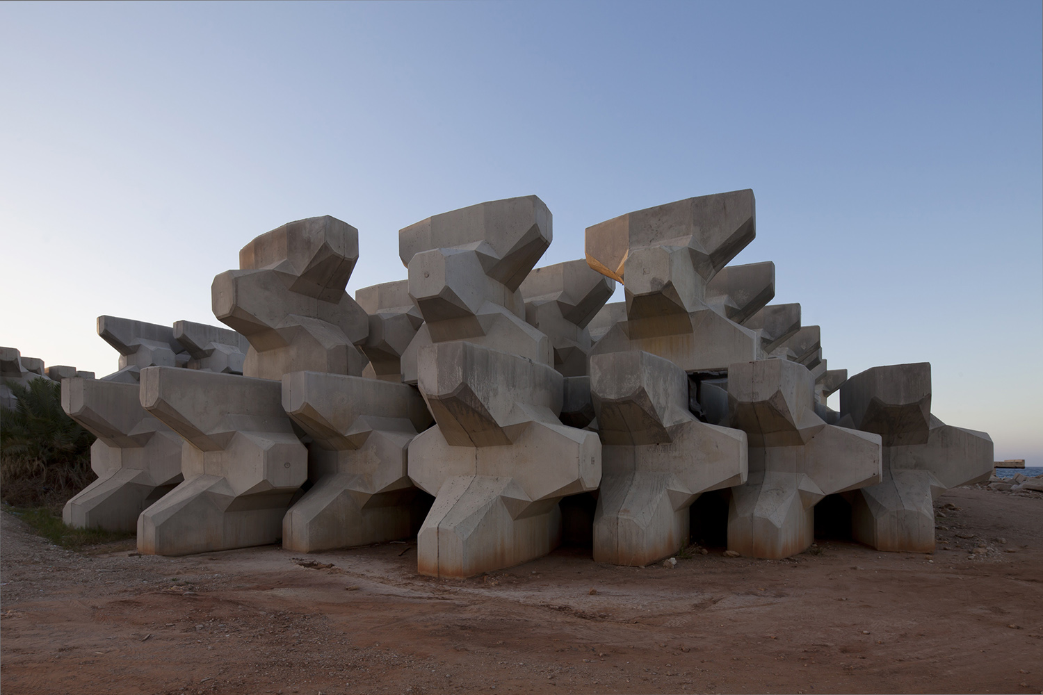
Each of these concrete objects are nearly ten feet in height, and are designed to offer the maximum possible resistance to movement by the force of tidal and wave pressures. They are poured on site with a licensing fee from the patent owner and then carried to sea on a massive floating crane for the construction of sea walls, coffer dams, and jetties. These acropodes await the construction of a second harbor in Beirut for luxury boats that arrive from all over the middle east and the Mediterranean.

In 2103, Solidere sal, my client on this project completed the annexing of ten acres along the Beirut Waterfront. This property will be for luxury multifamily high rise, public parks and sports infrastructure, and entertainment. The land was "reclaimed" by constructing long, massive coffer dams into the sea, then pumping the water out of the target area. The roads in this image will be part of a new park.

In 2103, Solidere sal, my client on this project completed the annexing of ten acres along the Beirut Waterfront. This property will be for luxury multifamily high rise, public parks and sports infrastructure, and entertainment. The land was "reclaimed" by constructing long, massive coffer dams into the sea, then pumping the water out of the target area.

This infrastructure photograph shows in the foreground, construction nearly complete for the roof deck of the Beirut Yacht Club by Stephen Holl Architects from New York. The scalloped forms in the background comprise a waterfront wall that is designed to stop the forward motion from an expected tsunami.


My client was DAR Al Handassah. Their man was watching from a safe distance while I shot this from the edge of a twelve story building next to the freeway. The Mediterranean was visible about a mile away, and the traffic was unusually light.


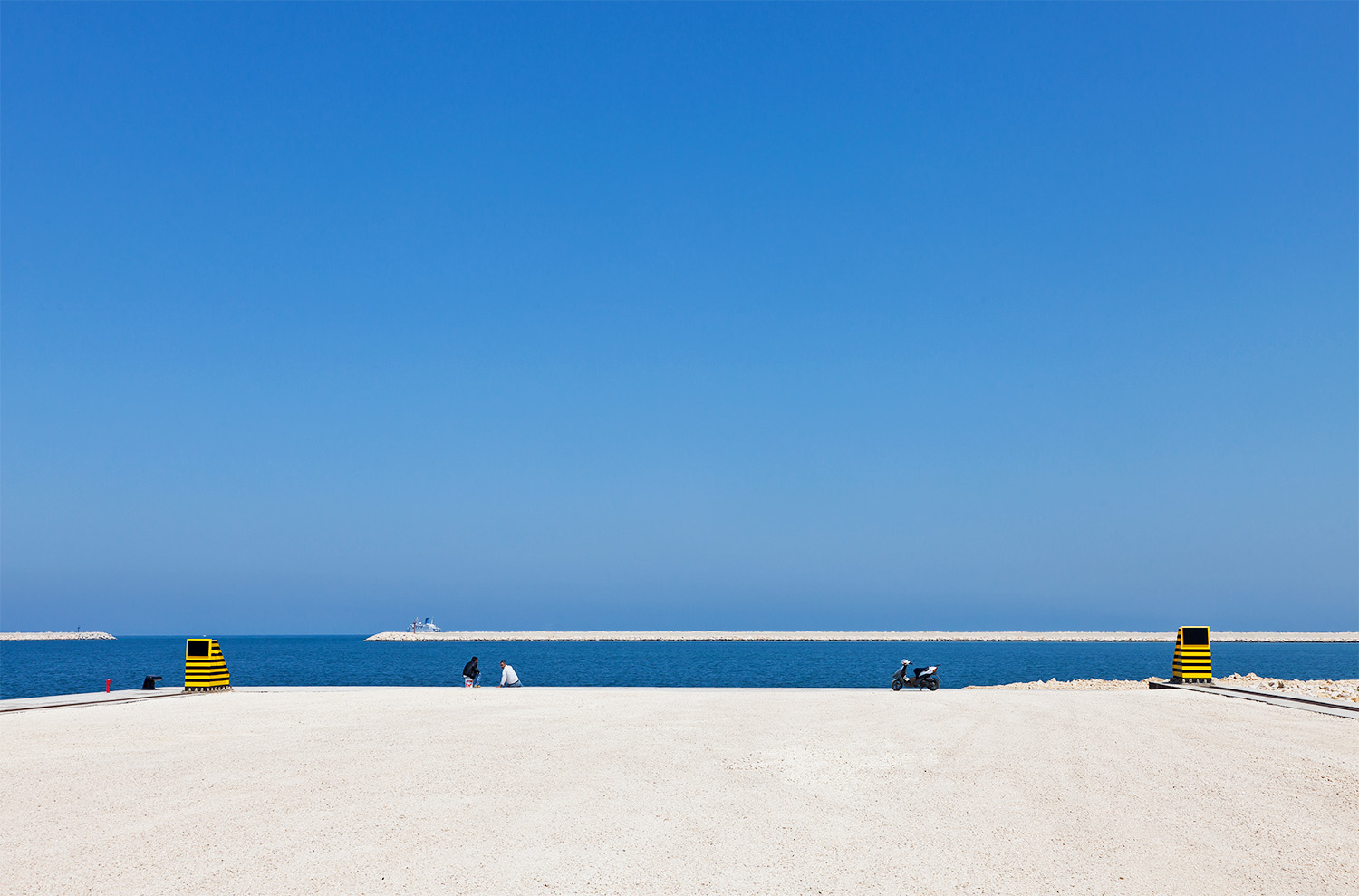
When Solidere took out about a kilometer of natural coastline in Beirut to add land for development, there was a public uproar. At the time of this photograph the uproar was beginning to fade, and people were beginning to come out in mass to walk along the wall created to break the force of a tsunami.

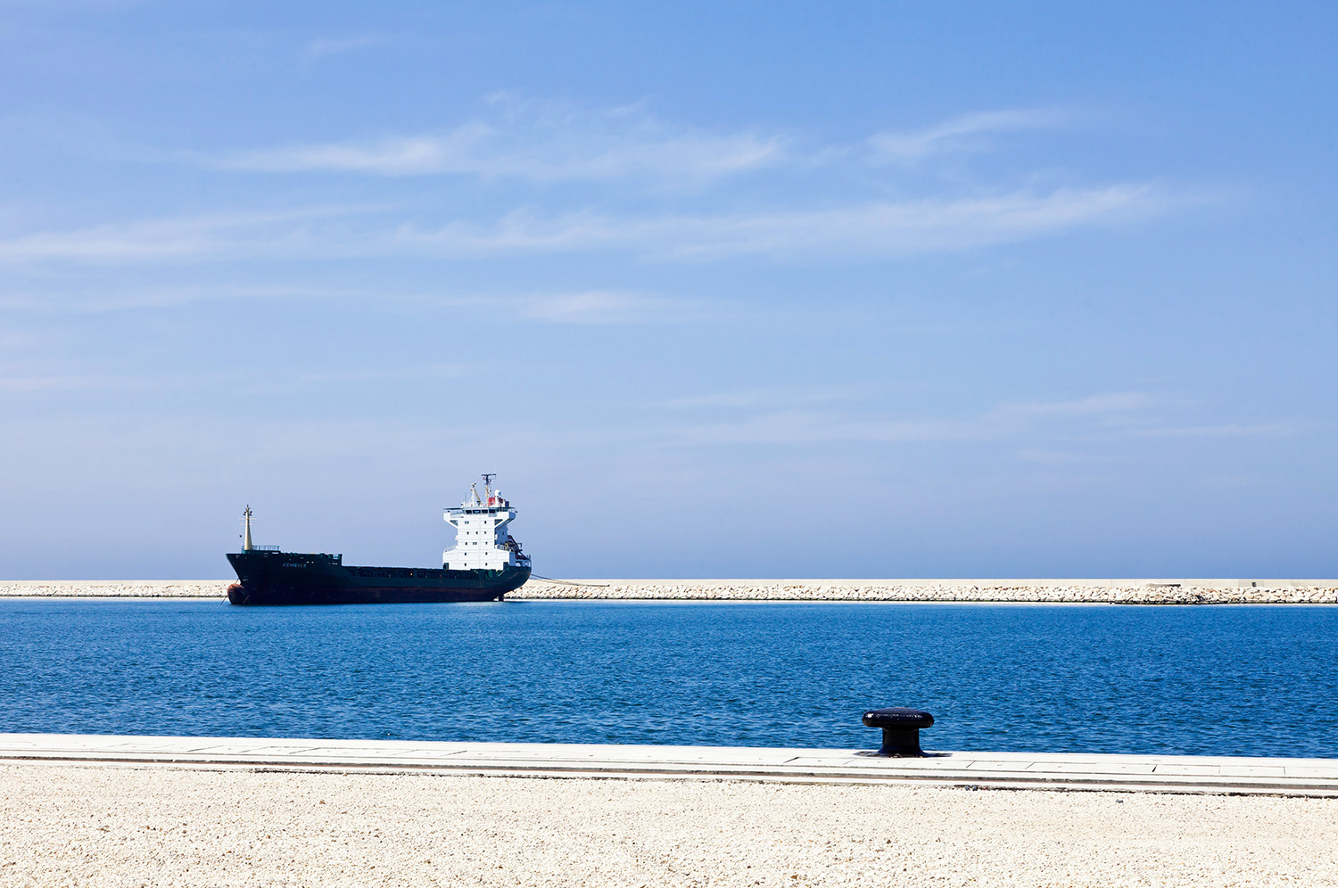
This annex had not officially opened to receive freight and was not yet equipped with its cranes when I photographed there. This made for a stunning minimalist industrial landscape. We were nearly barred from coming in and my client had to do some serious begging, as security was tightening up as the war in Syria was beginning to heat up. Tripoli is the closest metropolitan district to Homs, where the war was breaking as I photographed.
This annex had not officially opened to receive freight and was not yet equipped with its cranes when I photographed there. This made for a stunning minimalist industrial landscape. We were nearly barred from coming in and my client had to do some serious begging, as security was tightening up as the war in Syria was beginning to heat up. Tripoli is the closest metropolitan district to Homs, where the war was breaking as I photographed. The fisherman didn't seem to be worried.

This annex had not officially opened to receive freight and was not yet equipped with its cranes when I photographed there. This made for a stunning minimalist industrial landscape. We were nearly barred from coming in and my client had to do some serious begging, as security was tightening up as the war in Syria was beginning to heat up. Tripoli is the closest metropolitan district to Homs, where the war was breaking as I photographed. The ropes are tying down a massive freighter docked just to the left of the frame.

According to my pilot that day, the Port was loaded - more containers than he had ever seen there. Terminal Island is man-made and receives only the freight for Los Angeles. A similar port is directly next door for Long Beach.. The Los Angeles Port is actually within the Los Angeles City Limits, which follow along the rail lines to the port in a long bottle neck, all the way to Long Beach.

The Artesia Freeway (91) crosses the Los Angeles River and intersects with the Long Beach Freeway in a graceful cluster of arcing ramps.